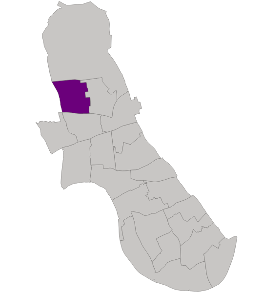
The ward profiles bring together a range of demographic and population related data for each ward in Hammersmith & Fulham.
They present key measures that help to define the characteristics of an area, the population it contains and the key issues it faces.
The main themes covered are:
- population
- health
- deprivation
- crime
- education and qualifications
- housing tenure
- economic activity
- local economy and businesses
Ward councillors
- Max Schmid (Labour)
- Nicole Trehy (Labour)
Ward description

Wormholt ward is located in the north of Hammersmith & Fulham, sandwiched between Westway (A40) to the north, Uxbridge Road to the south and White City ward to the east.
The ward is almost entirely residential in character, with most commercial premises situated alongside Uxbridge Road.
It is not as densely populated as the neighbouring White City ward, but over the past 20 years, the population has increased by 6%.
Wormholt ward is one of the most deprived areas of the borough with 39% of residents living in social rented accommodation.
The overall population is middle-aged and young, with poorer health, and comparatively unskilled. A high proportion of the population works in low-paid jobs, mainly in health and social care sector or wholesale and retail sector.
Around 1 in 7 households are classed as fuel poor – the 3rd highest proportion amongst all wards in H&F.
7,985
Population
2,989
Households
Characteristics of the ward
- The highest proportion of family households with children
- Lower house prices
- Higher proportion not employed and with no qualifications
- Higher proportion with poor health or disability
- The highest proportion of households in fuel poverty
Pockets of deprivation
Even though the ward is relatively affluent, there still exists some deprived areas that suffer from multiple interlinked problems.
This includes:
- Planetree Court
- Samuels Court
- Springvale Estate
- Wilfred Wood Court
Generally, these areas are characterised by:
- low skills
- low incomes
- worklessness
- social rented housing
- health issues
The ward is made up of 5 Lower Super Output Areas (LSOAs). 2 are ranked within the 20% most deprived nationally.
There are 7 deprivation 'domains' within the IMD 2019 and the highest scores for the ward are in:
- living environment
- crime
- barriers to housing and services
Top 5 ethnicities
- White British
- White Other
- Black African
- Mixed
- Black Caribbean
Top 5 languages
- English
- Arabic
- Spanish
- French
- Polish
Top 5 professions
- Professional occupations
- Associate professional
- Managers and directors
- Caring, leisure and other
- Elementary occupations
Top 5 industries
- Health and social work
- Wholesale and retail trade
- Education
- Professional, scientific and technical
- Information and communication